About
Kimberly
Travel Enthusiast, Ambitious Student, Avid Leaner.
Get to know me better through my experiences.
University of Washington
Bachelor of Art in Sustainable Urban DevelopmentAdvanced Placement and Honors classes paved the way for me to join UWT directly after highschool. Starting off as an Environmental Science major, I quickly learned I wanted to be on the technical side of achieving environmental sustainabiliy rather than the scientific side. After switching to the Urban Studies department, I not only completed a BA in SUD, but also a GIS Certificate, and Envrionmental Science Minor.
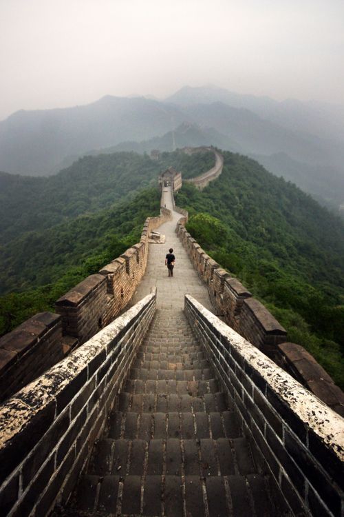
Study Abroad: China
East World Religion: Islam & BuddhismFrom the Forbidden City in Beijing, to Buddhist temples, Islamic Masjids, and the Magao Caves, this study abroad featured religious and cultural studies from East, to West China. This photo was taken at the Yueya Spring, a crescent lake in the middle of the Gobi Desert. Aside from studying religion in a place where religious choice was not always a priveledge, I gained proficiency in Mandarin and Cross-Culture Communication.

Study Abroad: New York
Icon of American UrbanismThe Urban Field Experience to New York centered around four themes: Immigration & residential patterns in Queens, Brooklyn, Industrial Transition & gentrification in Manhattan, Brooklyn, Urban Environmentalism such as parks, gardens, & green spaces throughout the city, and Community organizing and social change through various groups around the city, but most memorable in the Puerto Rican enclave of El Puente.
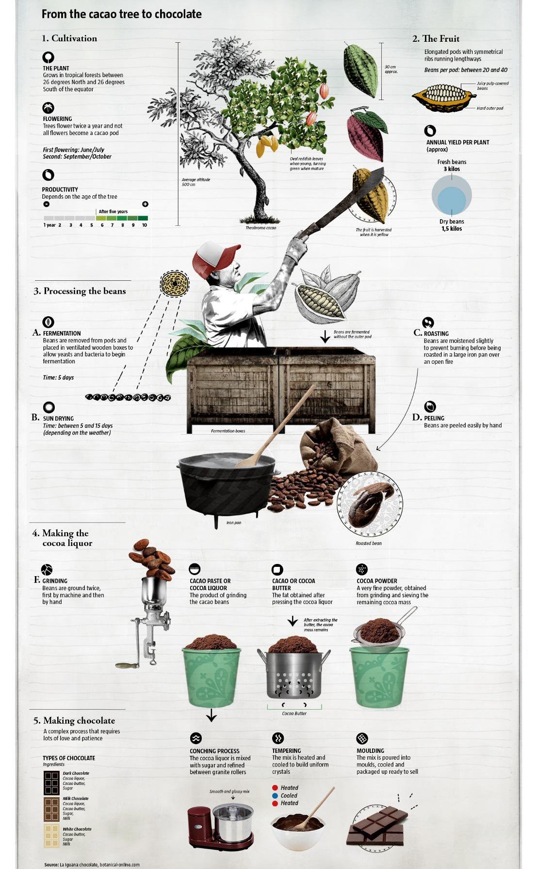
Internship: Costa Rica
Sustainable Agriculture and Conservation in the TropicsBased in the rural town of Mastatal, this internship featured working on an organic chocolate farm La Iguana Chocolate. Working from 5AM to 12PM with the Salazar Family, we made chocolate from scratch which starts with harvesting the cocao fruit. Fermentation, drying, roasting, tempering than molding into either bars or truffles. Increasing biodiversity through self-sufficiancy, and ecotourism is the goal of the Salazar Family.
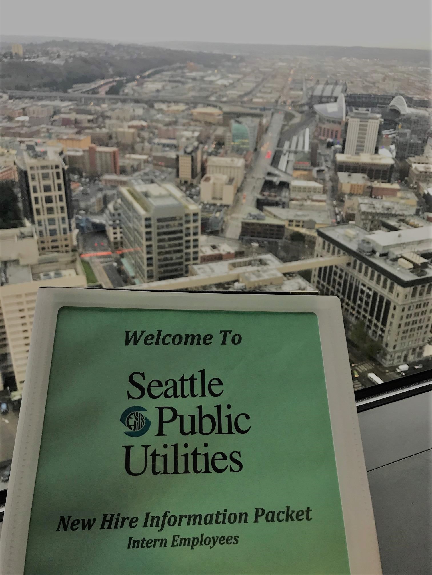
Internship: SPU
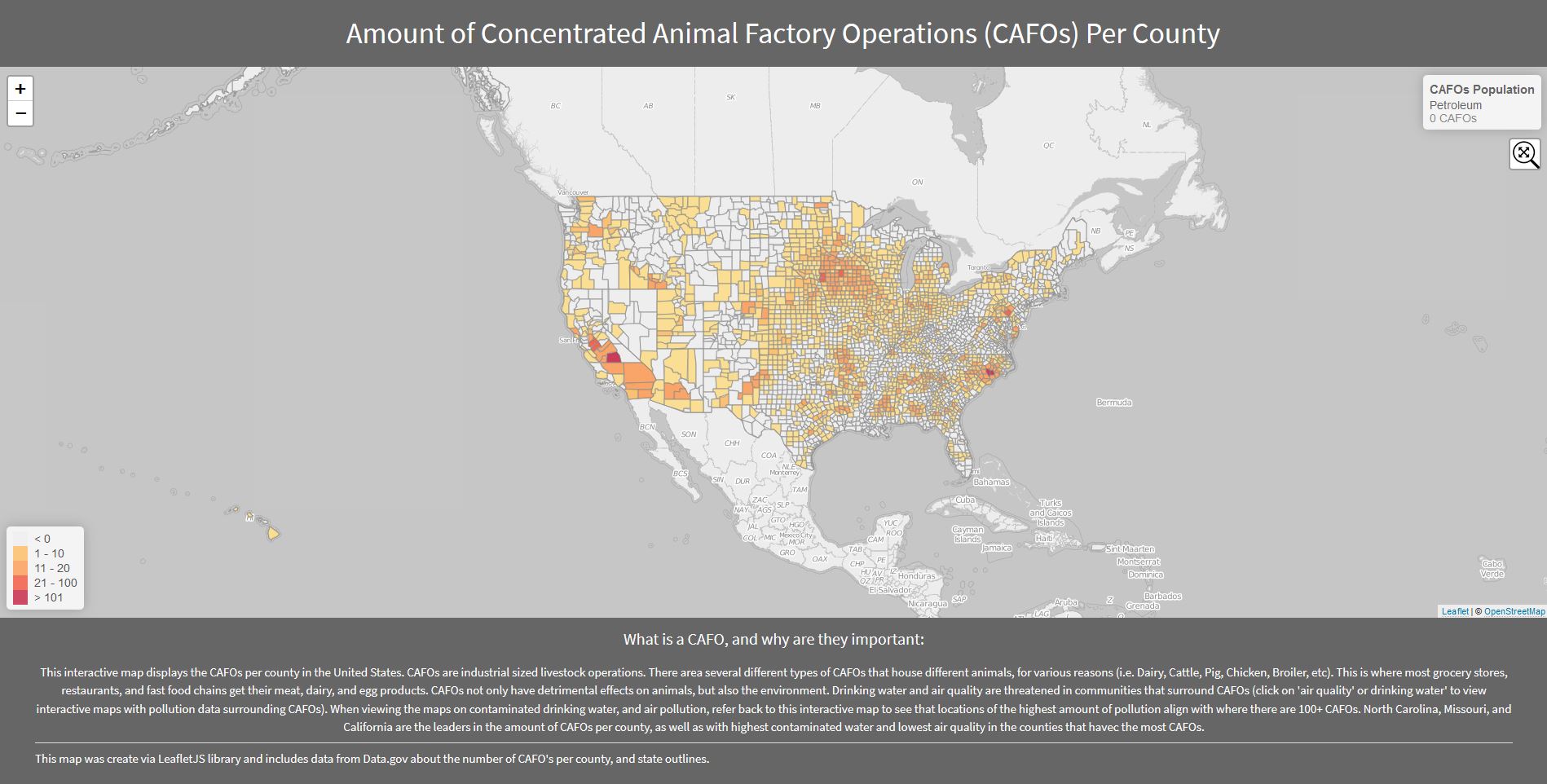
Geographic Information Systems InternPutting GIS skills from the classroom into practice with the Drainage and Wastewater Management team at SPU. I have recently been working on a major project called Move Seattle. Move Seattle is a strategic document that lays out work plans for the next 10 years. My part in this project is to map all existing infrastrucutre such as catch basins, inlets, solid waste, etc. The joke around the office is that we are all "Virtual Plumbers".
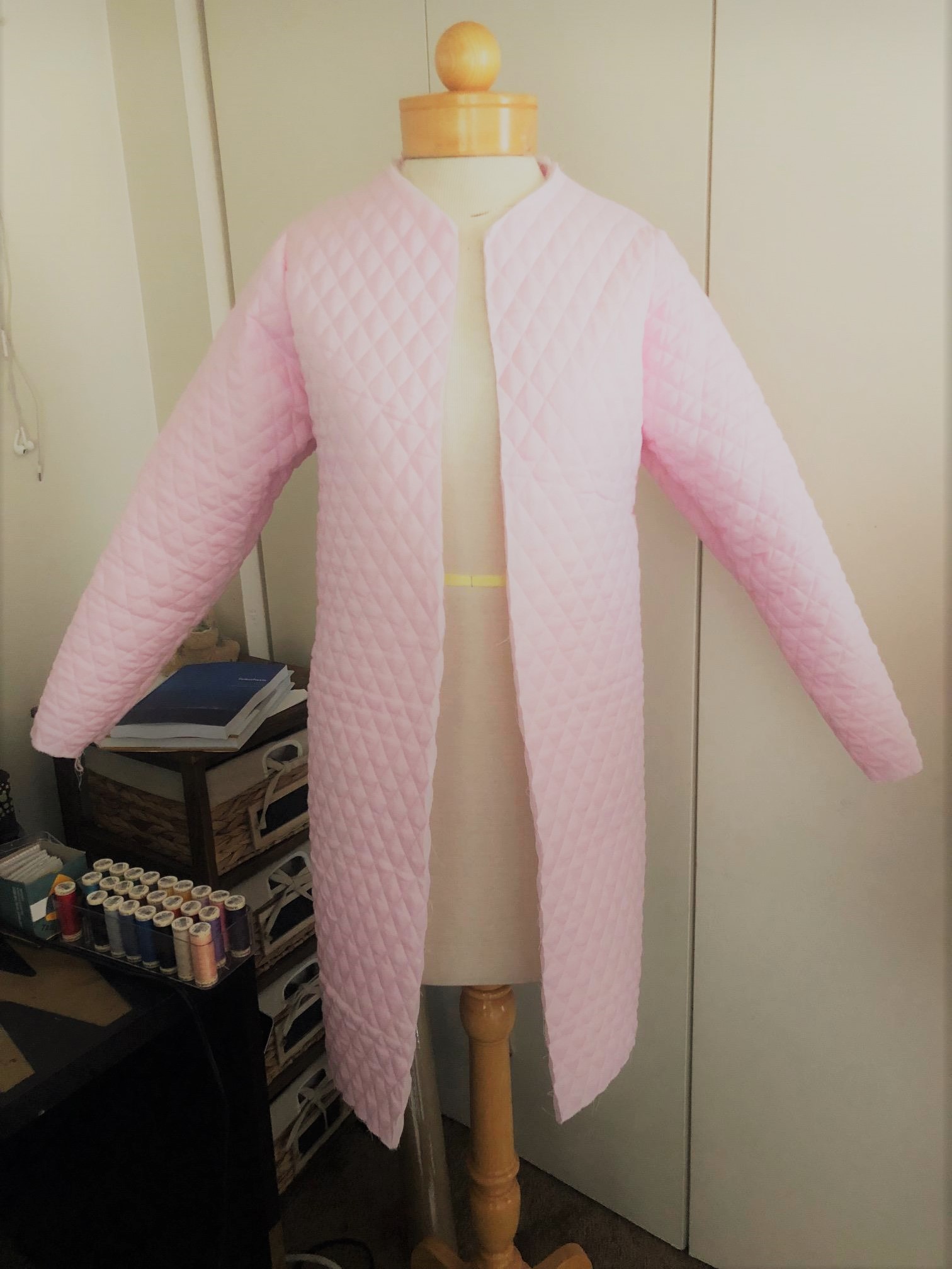
Sewing Hobbyist
To relieve stress & promote happinessShortly before starting my graduate degree, I realized I did not have an outlet to express my creativity outside of the classroom. Over the summer I started listening to several podcast for beginner sewers and watching television shows to familiarize myself with the vocabulary, and several youtube tutorials later I created my first quilted jacket (in the photo above). I look forward to learning, and mastering this new skill.
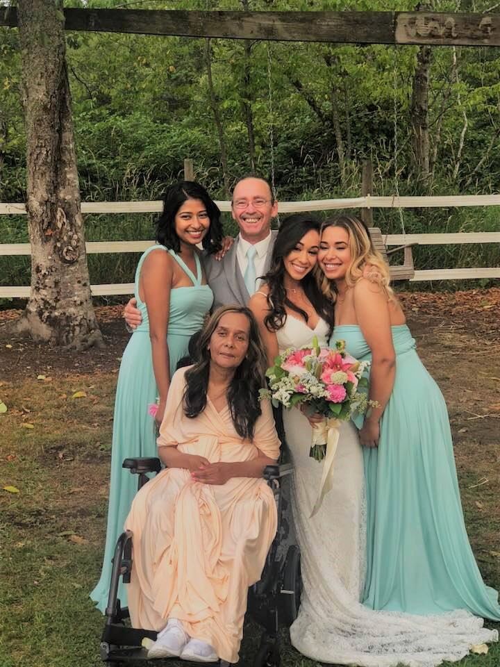
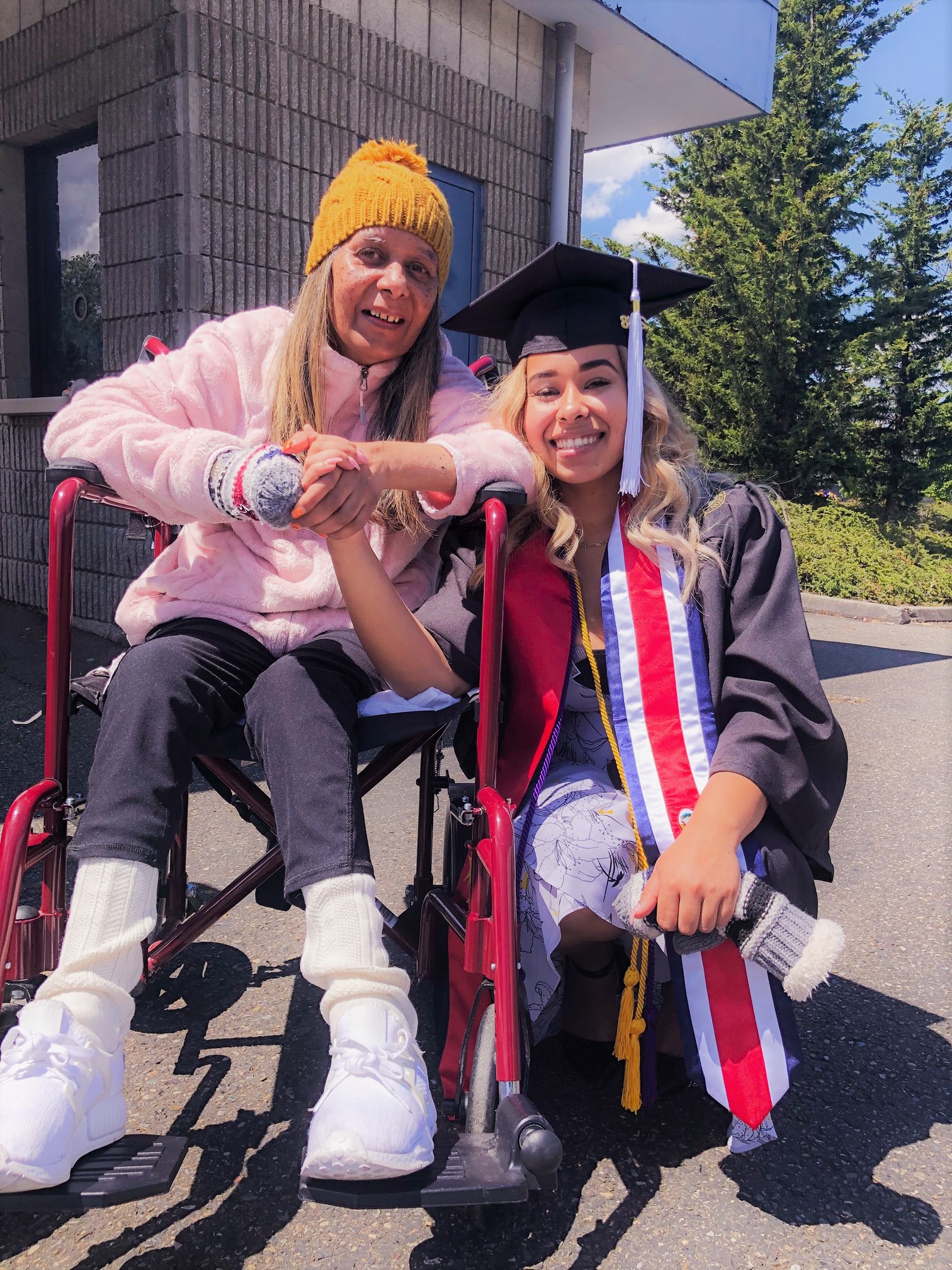
The Miles Family
Everlasting Love, Support & MotivationTheres nothing more comforting than knowing your family supports you 100%, and will always give the motivation to be your best self. I am the youngest of 3 girls, and have broken the generational curse of achieving higher education. Since beginning at UW in 2013, my sisters have both enrolled in college and are very close to completing their degrees, my father has also considered going back to school as a retiree.
MSGT
Program
Master of Science in Geospatial Technologies
University of Washington Tacoma